- Home
- Our Fleet
- Popular Routes
- Dehradun to Delhi Cabs
- Dehradun to Haridwar Taxi Service
- Dehradun to Mussoorie Cabs
- Dehradun to Jollygrant Airport
- Dehradun to Rishikesh Cabs
- Dehradun to Chandigarh Cabs
- Dehradun to Shimla Cabs
- Dehradun to Manali Cabs
- Dehradun to Chardham Yatra CAB Service
- Dehradun to Dharamshala Cabs
- Dehradun to Himachal Pradesh
- Dehradun to Jaipur
- Dehradun to Jalandhar
- Dehradun to Kalka Cabs
- Dehradun to Ludhiana Cabs
- Packges
- About Us
Dehradun to Himachal Pradesh Cabs
Himachal Pradesh
Dehradun to Himachal Pradesh is about 228.6 km (takes about 5 hours 55 min), get Dehradun to Himachal taxi service at Dehradun cabs. Himachal Pradesh is a state in Northern India. Its area is 21,495 sq mi (55,670 km2), and is bordered by Jammu and Kashmir on the north, Punjab on the west, Haryana on the south-west, Uttarakhand on the south-east and the Tibet Autonomous Region on the east.
Himachal Pradesh is famous for its abundant natural beauty. After the war between Nepal and Britain, also known as the Anglo-Gorkha War (1814–1816), the British colonial government came into power and the land now comprising Himachal Pradesh became part of the Punjab Province of British India.

In 1950, Himachal was declared a union territory, but after the State of Himachal Pradesh Act 1971, Himachal emerged as the 18th state of the Republic of India. Hima means snow in Sanskrit, and the literal meaning of the state’s name is “In the lap of Himalayas”. It was named by Acharya Diwakar Datt Sharma, one of the great Sanskrit scholars of Himachal Pradesh. The economy of Himachal Pradesh is currently the third-fastest growing economy in India. Himachal Pradesh has been ranked fourth in the list of the highest per capita incomes of Indian states. This has made it one of the most wealthy places in entire South Asia. The abundance of perennial rivers enables Himachal to sell hydroelectricity to other states such as Delhi, Punjab, and Rajasthan. The economy of the state is highly dependent on three sources: hydroelectric power, tourism, and agriculture. Himachal Pradesh is spread across valleys, and 90% of the population lives in villages and towns. However, the state has achieved 100% hygiene and practically no single house is without a toilet. The villages are well connected to roads, public health centers, and now with Lokmitra Kendra using high-speed broadband. Shimla district has a maximum urban population of 25%. According to a 2005 Transparency International survey, Himachal Pradesh has ranked the second-least corrupt state in the country after Kerala. The hill stations of the state are among the most visited places in the country. The government has successfully imposed environmental protection and tourism development, meeting European standards, and it is the only state which forbids the use of polyethylene and tobacco products.
Popular Destinations in Himachal Pradesh

shimla
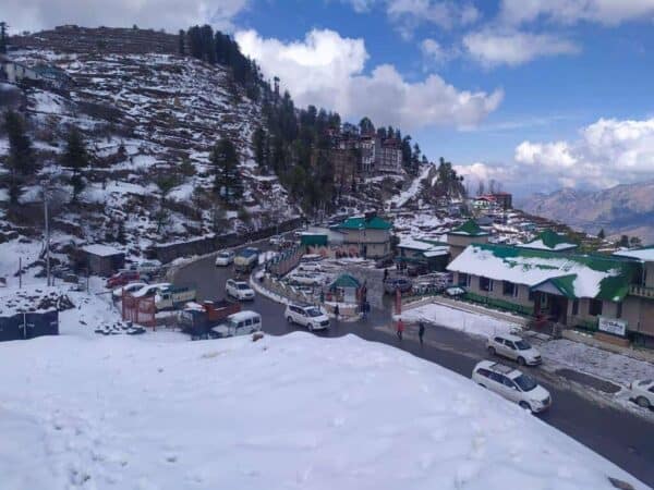
Shimla or in British Indian orthography, Simla, is the capital city of the Indian state of Himachal Pradesh, located in northern India. Shimla acts as a hub for India’s tourism sector. In 1864, Shimla has officially designated the summer capital of British India, succeeding Murree, northeast of Rawalpindi. After independence, Lahore was given to Pakistan and Shimla became the capital of Punjab and was later the capital of Himachal Pradesh. After reorganisation, the Mahasu district and its major portion were merged with Shimla. Its name is derived from the goddess Shyamala Devi, an incarnation of the Hindu goddess Kali. Shimla historically contained the 19 hill states of Baghal, Baghat, Balsan, Bashar, Bhajji, Bija, Dakota, Dhami, Jubal, Keonthal, Kumharsain, Kunihar, Kuthar, Mahlon, Mangal, Nalagarh (Hindu), Sangri and Thach. Shimla is home to several colleges and research institutions as well as multiple temples and palaces. The city’s buildings are styled in the Tudorbethan and neo-Gothic architectures dating from the colonial era. Owing to its steep terrain, Shimla hosts the mountain biking race MTB Himalaya, which started in 2005 and is regarded as the biggest event of its kind in South Asia.
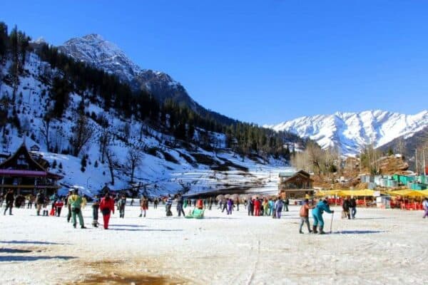
Manali is a hill station nestled in the mountains of the Indian state of Himachal Pradesh near the northern end of the Kullu Valley, at an altitude of 2,050 m (6,726 ft) in the Beas River Valley. It is located in the Kullu district, about 270 km (168 mi) north of the state capital, Shimla. The small town, with a population of 8,096, is the beginning of an ancient trade route to Ladakh and from there over the Karakoram Pass on to Yarkand and Khotan in the Tarim Basin. It is a popular tourist destination and serves as the roadway to other northern hill stations.

manali

Dharamsala
Dharamsala is a city and a municipal council in Kangra district in the Indian state of Himachal Pradesh. It is the district headquarters. It was formerly known as Bhagsu. The Dalai Lama’s residence and the headquarters of the Central Tibetan Administration (the Tibetan government in exile) are in Dharamshala. Dharamshala is 18 kilometres from Kangra. Dharamshala is a city in the upper reaches of the Kangra Valley and is surrounded by dense coniferous forest consisting mainly of stately Deodar cedar trees. The suburbs include McLeodGanj, Bhagsunath, Dharamkot, Naddi, ForsythGanj, Kotwali Bazaar (the main market), and Kaccheri Adda (government offices such as the court, police, post, etc.), Dari, Ramnagar, Sidhpur, and Sidhbari (where the Karmapa is based). The village of McLeodGanj, lying in the upper reaches, is known worldwide for the presence of the Dalai Lama. On 29 April 1959, the 14th Dalai Lama (Tenzin Gyatso) established the Tibetan exile administration in the north Indian hill station of Mussoorie. In May 1960, the Central Tibetan Administration (CTA) was moved to Dharamshala. Dharamshala is the centre of the Tibetan exile world in India. Following the 1959 Tibetan uprising, there was an influx of Tibetan refugees who followed the 14th Dalai Lama. His presence and the Tibetan population have made Dharamshala a popular destination for Indian and foreign tourists, including students studying Tibet. One of the main attractions of Dharamshala is Triund hill. Jewel of Dharamshala, Triund is one day trek at the upper reaches of McLeodGanj, about 9 km from McLeodGanj. So, book the best Dehradun to Himachal taxi service.
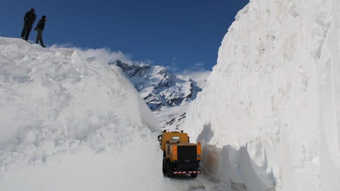
Rohtang Pass is a high mountain pass on the eastern Pir Panjal Range of the Himalayas around 51 km (32 mi) from Manali. It connects the Kullu Valley with the Lahaul and Spiti Valleys of Himachal Pradesh, India. Manali-Leh Highway, a part of NH 21, transverses Rohtang Pass.
The pass provides a natural divide between the humid Kullu Valley with a primarily Hindu culture (in the south), and the arid high-altitude Lahaul and Spiti valleys with a Buddhist culture (in the north). The pass lies on the watershed between the Chenab and Beas basins. On the southern side of this pass, the Beas River emerges from underground and flows southward and on its northern side, the Chandra River (flows from the eastern Himalayas), a source stream of the river Chenab, flows westward.

Rohtang Pass

Dalhousie
Dalhousie s a hill station in Chamba district in the northern state of Himachal Pradesh, India. It is situated on 5 hills and has an elevation of 2,400 metres above sea level. The Dalhousie Town was named after Lord Dalhousie who was the British Governor-General in India and established this place as a summer retreat. Dalhousie is a hill station in Himachal Pradesh, established in 1854 by the British Empire in India as a summer retreat for its troops and bureaucrats. It is built on and around five hills, Kathalagh, Potreyn, Terah, Bakrota and Bhangra. Located on the western edge of the Dhauladhar mountain range of the Himalayas, it is surrounded by snow-capped peaks. Dalhousie is situated between 6,000 and 9,000 feet (2,700 m) above sea level. The best time to visit is in the summer, and the peak tourist season is from May to September. Scottish and Victorian architecture is prevalent in the bungalows and churches in the town. Dalhousie is a gateway to the ancient Chamba Hill State, now Chamba District of the state of Himachal Pradesh of India. This hill region is a repository of ancient Hindu culture, art, temples, and handicrafts preserved under the longest-running single dynasty since the mid-6th century. Chamba is the hub of this culture. Bharmour, the ancient capital of this kingdom, is home to the Gaddi and Gujjar tribes and has 84 ancient temples dating from the 7th to–the 10th century AD.
Kasauli is a cantonment and town, located in Solan district in the Indian state of Himachal Pradesh. The cantonment was established by the British Raj in 1842 as a Colonial hill station, 77 km from Shimla, 65 km from Chandigarh, and 94 km from Ambala Cantt (Haryana), an important Railway Junction of North India and lies at a height of 1,927 metres (6,322 ft). The town is a health resort, having an elevation of 1,900 metres above sea level.
According to the 2001 India census, Kasauli had a population of 4994. Males constituted 56% of the population, and females 44%. Kasauli had an average literacy rate of 80%, higher than the then national average of 75.5%; male literacy was 84% and female 76%. 10% of the population was under 6 years of age.
Kasauli has a moderate climate. Winter temperature is approximately 2 degrees Celsius, with Summer temperatures rarely exceeding 32 degrees Celsius or more. The general wind direction is southwest to northeast. Total rainfall for the year is 1020 millimetres, with humidity at 90% in September and 28% in April.

Kasauli

Kullu
Kullu, or Kulu, is the capital town of the Kullu District in the Indian state of Himachal Pradesh. It is located on the banks of the Beas River in the Kullu Valley about ten kilometres north of the airport at Bhuntar.
Kullu is a broad open valley formed by the Beas river between Manali and Large. This valley is famous for its temples, beauty and its majestic hills covered with pine and deodar forest and sprawling apple orchards. The course of the Beas river presents a succession of magnificent, clad with forests of deodar, towering above trees of pine on the lower rocky ridges. Kullu valley is sandwiched between the Pir Panjal, Lower Himalayan and Great Himalayan ranges.
The Kullu Valley is the largest in the Kullu district, in the state of Himachal Pradesh, India. The Beas River runs through the middle of the valley.
Kufri is a small hill station in the Shimla district of Himachal Pradesh state in India. It is located 13 km from the state capital Shimla on National Highway No.22. Kufri with NH-22, Shimla district. The name Kufri is derived from the word kufr meaning “lake” in the local language. The highest point in the surrounding region, Kufri has a Himalayan wildlife zoo that hosts rare antelopes, felines and birds including the Himalayan monal, the state bird of Himachal Pradesh. During winter a meandering path through the potato plantations turns into a popular ski track.

Kufri

Paonta Sahib
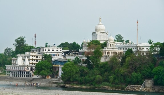
Paonta Sahib is a small industrial town in the south of Sirmour district in the Indian state of Himachal Pradesh. National Highway 72 goes through this town. It is an important religious spot for Sikhs. Major industries are cement production (Cement Corporation of India, Rajan), power generation and renewable energy, pharmaceuticals Sun Pharmaceutical Industries Limited, Mankind Pharma Limited, Zee Laboratories Limited), textiles (Malwa cotton and spinning mills of Oswal group), chemicals and food. Some of the major hotels and Resorts to stay there are Hotel Guru Surbhi, Hotel Yamuna, Hotel Ponta Valley, and Hotel Rockwood. The city has a large Gurdwara, named Gurudwara Paonta Sahib, on the banks of the river Yamuna. The river is the boundary between the states of Himachal Pradesh and Uttarakhand. So, Book the best and reliable Dehradun to Himachal Taxi Service.
